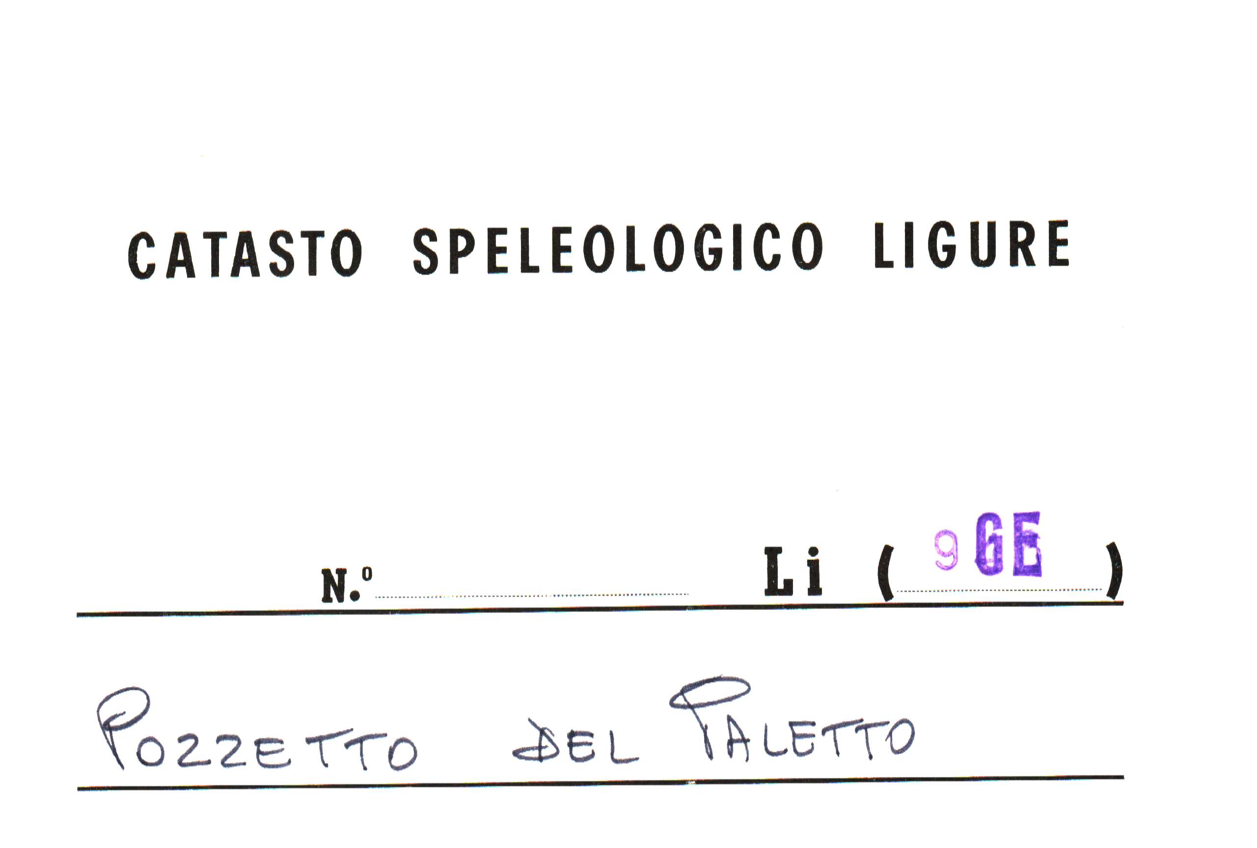
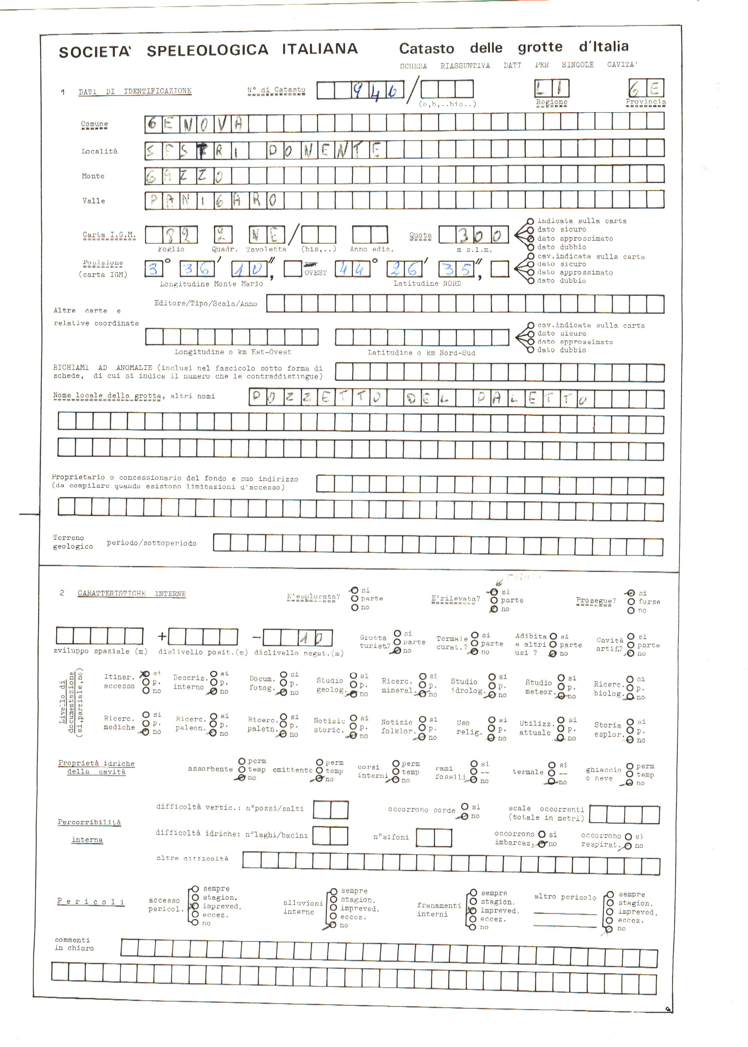
LI946
POZZETTO DEL PALETTO
Firstreference
ARENA P.
Regione
LIGURIA
Provincia
GE
Comune
GENOVA
Localita
SESTRI P.
Areas
Size
Lenght total
19
Lenght planimetric
0
Lenght extension
0
Depth positive
0
Depth negative
-10
Depth total
10
Entrance location
Latitude
44°26'35''N
Longitude
3° 36' 10'' Ovest di Monte Mario
Coordinates type
IGM 1:25000 Geografiche M.Mario (OVEST)
Original coordinates type
IGM 1:25000 Geografiche M.Mario (OVEST)
Elevation
300
Elevation gps
0
Location evaluation
DATI STIMATI,RICAVATI DALLA CARTA DEL BOLLETTINO SPELEORAMA DEL 1975
Archeological
No
Marine
No
Environmentalrisk
No
Associations
GRUPPO RICERCHE SCIENTIFICHE STALATTITE
Notes
ad ora non è stato possibile identificare l'ingresso della grotta, verificare se ancora esistente
Itinerary
Pendice Est del Monte Gazzo, nello sperone roccioso non ancora coltivato da cave ()
Import rawdata
1{_"REGIONE":"LI","PROV":"GE","NUM":"946","SPECIF":"1","DATAGG":null,"DRILEV":"1987-12-31","NOME":"POZZETTO DEL PALETTO","SINON":null,"RAS":"N","COMUNE":"GENOVA","LOCAL":"SESTRI P.","ACAR":"MONTE GAZZO","ACARCOD":"GE33","FM":null,"FMCOD":null,"AGE":null,"SVILRE":"19","SVILPLAN":"0","ESTEN":"0","DPOS":"0","DNEG":"-10","DTOT":"10","TC_01":"IGM 1:25000 Geografiche M.Mario (OVEST)","latitude":" 44\u00b026'35''N","longitude":"3\u00b0 36' 10'' Ovest di Monte Mario","DC_01":null,"SC_01":null,"AE_01":"0","QA_01":"300","QC_01":null,"VD_01":"DATI STIMATI,RICAVATI DALLA CARTA DEL BOLLETTINO SPELEORAMA DEL 1975","IDRO":null,"RILEVATORI":"ARENA P.","GRADORIL":null,"GRUPPI":"GRUPPO RICERCHE SCIENTIFICHE STALATTITE","NOTE":"ad ora non \u00e8 stato possibile identificare l'ingresso della grotta, verificare se ancora esistente","NOTE2":null,"RCS":null,"ITINERARIO":"Pendice Est del Monte Gazzo, nello sperone roccioso non ancora coltivato da cave ()","recordinsert":"2010-07-10 01:32:02","recordupdate":"2018-02-27 15:44:27","username":"admin","userupdate":"alessandrovernassa","marina":"N","archeologica":"N","rischioambientale":"N","chiusa":"N","noteversione":"ripristinato il dato storico, le coordinate geografiche erano pi\u00f9 coerenti con la quota","data_verifica":null}
Dati compilazione
Recordinsert
10/07/2010
Username
admin
Userupdate
alessandrovernassa
Recordupdate
27/02/2018
Coordinate WGS84 (Lon,Lat):
Coordinate WGS84 (Lon,Lat):
Coordinate WGS84 UTM (x,y,zone):
Bibliography
| 1992 | Esplorare in Alla Val Chiaravagna | DE BIASI Mario | View |
Schede storiche Issel:

Genera scheda catastale
Download update form