LI1866
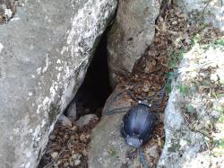
GROTTA DI CIMA CASTELLARO
Firstreference
ALESSANDRO VERNASSA - HENRY DE SANTIS
Regione
LIGURIA
Provincia
SV
Comune
BORGIO VEREZZI
Localita
CASTELLARO
Areas
Size
Lenght extension
15
Depth negative
4
Depth total
4
Entrance location
Latitude
44°10'19.5'' N
Longitude
8°18'35.7'' E
Coordinates type
GPS Geografiche WGS84
Original coordinates type
GPS Geografiche WGS84
Elevation
320
Archeological
No
Marine
No
Environmentalrisk
No
Hydrology
dry
Trend
SUBORIZZONTALE
Practicability
FACILE
Associations
S.C. G. RIBALDONE GENOVA
Notes
i dati riguardo sviluppo e profondità sono aprossimativi
History
Grotta segnalata da Francesco Pisano e Giovanni Laiolo nel 2014
Authorphoto1
H. De Santis
Import rawdata
1{_"REGIONE":"LIGURIA","PROV":"SV","NUM":"1866","SPECIF":null,"DATAGG":null,"DRILEV":null,"NOME":"GROTTA DI CIMA CASTELLARO","SINON":null,"RAS":null,"COMUNE":"BORGIO VEREZZI","LOCAL":"CASTELLARO","ACAR":null,"ACARCOD":"SV29,SV29","FM":null,"FMCOD":null,"AGE":null,"SVILRE":null,"SVILPLAN":null,"ESTEN":"15","DPOS":null,"DNEG":"4","DTOT":"4","TC_01":"GPS Geografiche WGS84","latitude":"44\u00b010'19.5'' N","longitude":"8\u00b018'35.7'' E","DC_01":null,"SC_01":"312","AE_01":null,"QA_01":"320","QC_01":null,"VD_01":null,"IDRO":"secca","RILEVATORI":"ALESSANDRO VERNASSA - HENRY DE SANTIS","GRADORIL":null,"GRUPPI":"S.C. G. RIBALDONE GENOVA","NOTE":null,"DATARIL":null,"NOTE2":"i dati riguardo sviluppo e profondit\u00e0 sono aprossimativi","RCS":null,"PERCORRIBILITA":"FACILE","oricoordtype":"GPS Geografiche WGS84","recordinsert":"2014-12-28 19:50:00","recordupdate":"2015-01-08 20:29:54","username":"henrydesantis","userupdate":"alessandrovernassa","marina":"N","archeologica":"N","rischioambientale":"N","chiusa":"N","ANDAMENTO":"SUBORIZZONTALE","data_verifica":null,"photo1":"2014-12-28 13.29.46.jpg","STORIA":"Grotta segnalata da Francesco Pisano e Giovanni Laiolo nel 2014","authorphoto1":"H. De Santis"}
Dati compilazione
Recordinsert
28/12/2014
Username
henrydesantis
Userupdate
alessandrovernassa
Recordupdate
17/02/2022
Coordinate WGS84 (Lon,Lat):
Coordinate WGS84 (Lon,Lat):
Coordinate WGS84 UTM (x,y,zone):
Genera scheda catastale
Download update form
